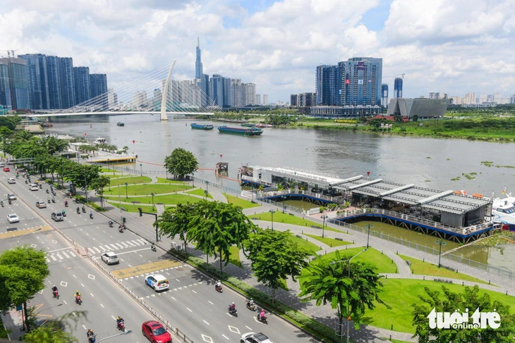
Over 520km of Ho Chi Minh City's waterways digitized to standard according to the current state
The Waterway Management Center of the Ho Chi Minh City Department of Transportation has announced that in 2023, the unit completed the digitization of 82 routes with over 523km of waterways in the city to enhance management efficiency.
According to Mr. Nguyen Ngoc Tuan, the Director of the Waterway Management Center, the digitization of survey data and information on inland waterway channels, as well as the infrastructure both on the routes and on land, integrated into the electronic portal of Ho Chi Minh City's Department of Transportation, is aimed at providing information to the public
At the same time, this digitization serves the management and exploitation of waterway infrastructure efficiently and is commensurate with the available potential.
Specifically, in 2023, the Waterway Management Center (the implementing unit) completed the digital model of the current state of all 82 waterways in Ho Chi Minh City with a total length of over 523km. The total underwater area is over 5,500 hectares, and the total area of the sloping roofs and both banks is over 10,000 hectares.
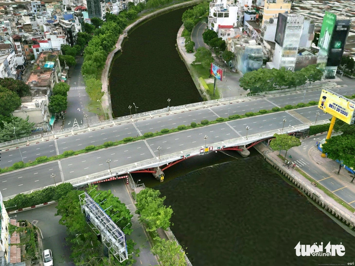
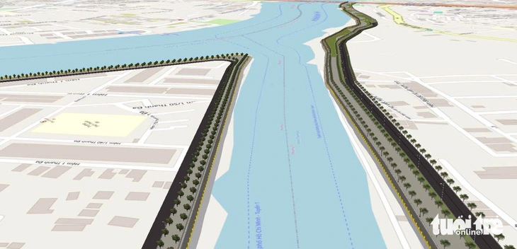
Not only that, but 217 overpass structures (bridges and culverts), 146 ports and inland waterway wharfs, and the design of typical landscapes along the banks of 82 routes have also been completed using the most advanced technology in the world, BIM - GIS, 3D. This meets the requirements of the Government and Ho Chi Minh City regarding the application of Building Information Modeling (BIM) and the integration of construction information models into the Geographical Information System (GIS).
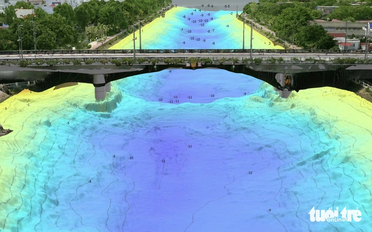
Thanks to this, management units in Ho Chi Minh City can accurately capture the depth of the waterway bed, identify the centerline of the waterway route, its layout, and the infrastructure of the transport on the route. This allows them to propose dredging maintenance and regulating the waterway channel.
Additionally, this is also a necessary data source for carrying out the filling of scour holes, reinforcing the banks of waterway routes, and constructing structures to prevent tidal flooding and erosion (dikes, embankments, revetments, tide control culverts, etc.) to ensure the safety of residential areas in regions along rivers, canals, and streams," Mr. Tuấn stated.
Mr. Tuan also shared that in the coming years, the unit will be able to monitor water levels, implement measures to inspect structures along the route, and provide information to ships and boats for navigation.
Specifically, for the existing series of embankment structures, timely maintenance and repair solutions are implemented to maintain the normal operation of the structures. This is achieved through the identification of the current 3D status of the existing banks for managing riverside structures and addressing encroachments on riverbanks and canals.
Experts assess that this is the first time in Vietnam that digital technology has been applied in its entirety to a large-scale inland waterway project. This reflects the determination for digital transformation and the enhancement of infrastructure management effectiveness by the Ho Chi Minh City People's Committee and the Ho Chi Minh City Department of Transportation.
Previously, at the launching ceremony for the competition to accelerate the progress of key transportation projects in Ho Chi Minh City, the Vice Chairman of the Ho Chi Minh City People's Committee, Mr. Bui Xuan Cuong, requested that units move towards digital transformation. This includes building information models for road and waterway transport infrastructure, to improve management and exploitation.
Ho Chi Minh City Leads in Digital Transformation for Waterway Management
According to the Waterway Management Center, the entire landscape of Ho Chi Minh City's inland waterways is built on an integrated platform of Building Information Modeling (BIM) and Geographic Information System (GIS). This digital model, in 3D form, comprehensively integrates various layers of data for managing Ho Chi Minh City's inland waterways.
The information includes the depth of the water channel, the current status along both banks, overpass structures, ports and inland waterway wharves, and the system of inland waterway signals...
On this digital map system, there is also integration of current state data and information on the planning of the infrastructure system for port and wharf facilities...
Source: tuoitre.vn
Pageviews: 0
Hình thành Trung tâm Logistics Cái Mép Hạ cùng với chức năng Khu thương mại tự do
Theo vlr.vn - 01/12/2023
Đó là khẳng định của ông Phạm Viết Thanh, Ủy viên ban chấp hành Trung ...
TP.HCM sẽ có những cây cầu độc đáo, không lặp lại, Portcoast tận dụng máy bay không người lái để khảo sát trên không nhằm tạo bản đồ 3D
Theo tuoitre.vn - 05/12/2023
Mời bạn đọc cùng Tuổi Trẻ Online xem phối cảnh độc đáo của cầu Thủ Thi...
Dự án Chuyển đổi Số Đa chức năng của Trường Đại học Bách khoa Thành phố Hồ Chí Minh
Theo vnuhcm.edu.vn - 29/11/2023
Chỉ với một thiết bị điện tử được kết nối Internet, người dùng có thể ...